Address to CSA lookup
Get the Census tract for a Baltimore City address, then match it to your Community Statistical Area (CSA) crosswalk.
Your CSA crosswalk is built in
The 2020 tract bridge is ready, so you don’t need to load the spreadsheet for each lookup.
Loading 199 Baltimore City tract mappings…
Enter an address
Use a complete street address, including Baltimore, MD and ZIP code if known.
Start with the house number and part of the street name to see local suggestions. A suggestion may need the final address checked by the Census Geocoder.
Census tract
Baltimore City CSA
Baltimore Police District
City Council District
CSA on the Baltimore City map
The circle marks the CSA label for this tract.
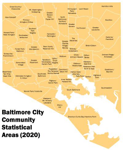
Interactive CSA map
All CSA names are shown. Hover over the highlighted CSA to brighten it and view its information.
Matched CSA Hover the highlighted area to see more.
Boundary source: Community Statistical Areas (2020), Baltimore Neighborhood Indicators Alliance.
Address privacy: street suggestions are matched locally from a Baltimore City street list; nothing is sent while you type. When you select “Find tract, CSA and districts,” the full address is sent to the U.S. Census Bureau Geocoder. The resulting map coordinates are then sent to Baltimore Police’s and Baltimore City’s public boundary services to identify the police and City Council districts. The crosswalk stays built into this page.